
Freya Muir

I am an IAPETUS2 PhD student based at the University of Glasgow, having completed my bachelor’s in Geology and Physical Geography and my master’s in GIS at the University of Edinburgh. My ultimate research goal is to create a framework for predicting shoreline change in a range of coastal environments in response to short- and medium-term weather events. I use information about the coast and storm impacts automatically derived and analysed from satellite and ground-based imagery and weather and wave forecasts, to feed into a numerical model of erosion response and shoreline change. I hope to establish a user-friendly, opensource software solution to predict a coastline’s response to upcoming storms that can be run regularly at a range of spatial and temporal scales by coastal managers and stakeholders. Prior to my PhD, I was the sole research assistant on the Dynamic Coast project, a Scottish government commissioned project to fill our evidence base of past, present and future coastal change around Scotland. My other research interests lie in topographic analyses of hillslope evolution (Figure 1A, 1B) and flood modelling (Figure 2), and I enjoy automating my analyses as much as possible with the use of programming and remotely sensed Earth Observation data. I love to find creative solutions and proxies for the processes and natural hazards we experience and are affected by on Earth’s surface, so that we may simulate and abstract, and therefore understand and predict them better.
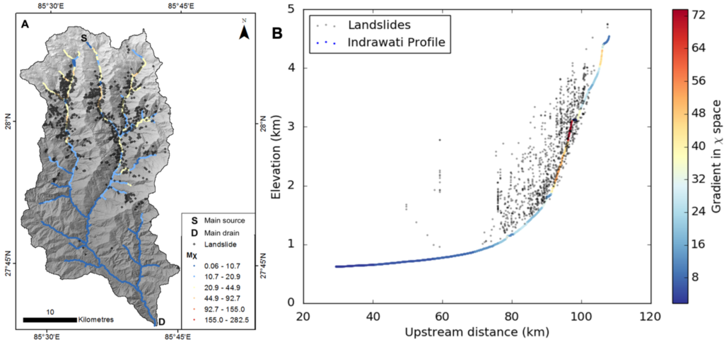
Figure 1A: Drainage network of the Indrawati River basin in Nepal represented by normalised channel steepness compared with landslide crown locations. 1B: River long profile showing landslide crown elevations on hillslopes and channel steepness in chi space.
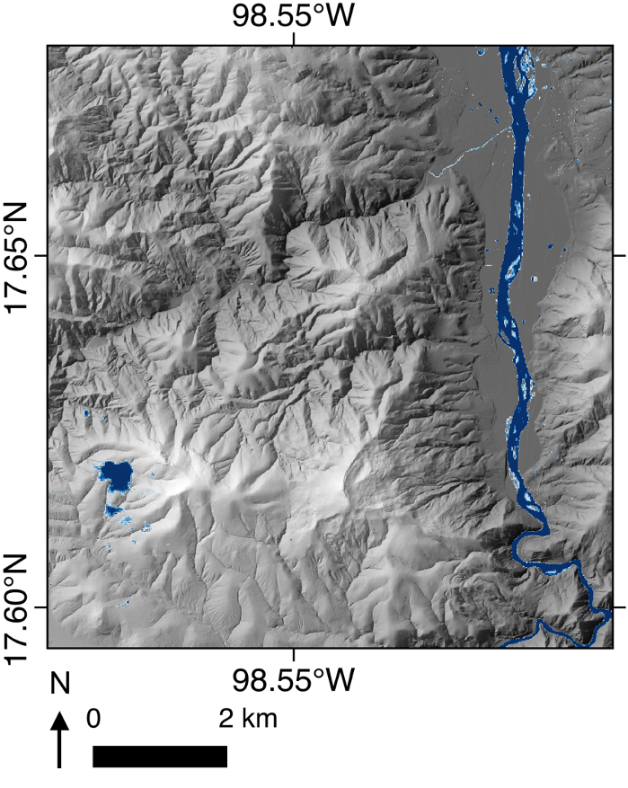
Figure 2: Flooded river water extent in Southern Mexico automatically extracted from Sentinel-2 imagery.